|
|
|||||||||||||||||||||||||
|
Doors to the Past |
|||||||||||||||||||||||||
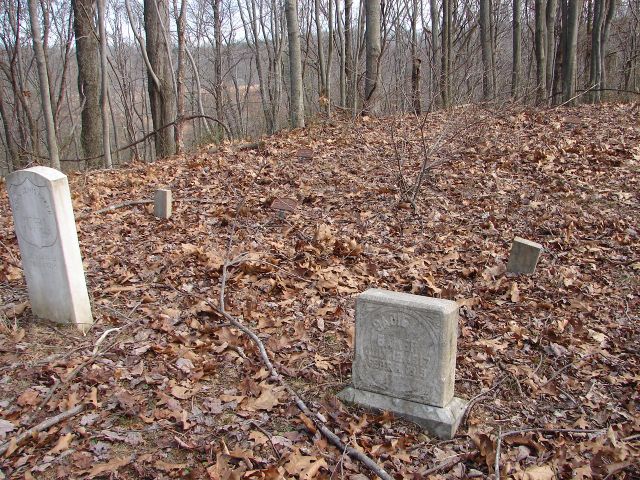
Baker (Valeria) CemeteryBAKER CEMETERY
Baker Detail ListLatitude: N 38° 17.444 From Barboursville take Route 10 to Salt Rock, Cabell County, West Virginia. At Salt Rock turn Right onto Madison Creek Road and go to Smith Creek Road. Turn Right onto Smith Creek Road and go 0.3 miles to the Madison United Baptist Church sign. Now turn Left onto Dog Fork Rd and go about 0.6 mile. Turn Left up this road and stay to your Right as you go up the hill. The cemetery is about 1.2 miles up this road. When you get to the top turn Right and go about 0.1 miles and the cemetery will be on your Left. This road is in very bad shape so you may need to walk up to the cemetery or take a ATV. The cemetery at one time was fenced and at this time is in very bad shape. Submitted by Barry Huffstutler.
This grave is marked with a Metal Marker only
This grave is marked with a Metal Marker only.
This grave is marked with a Metal Marker only.
Footstone: "S.M.B."
Footstone: "V.B." Note: There looks to be 3 unmarked graves in this cemetery.
|
|||||||||||||||||||||||||