|
|
|
|
Doors to the Past |
|
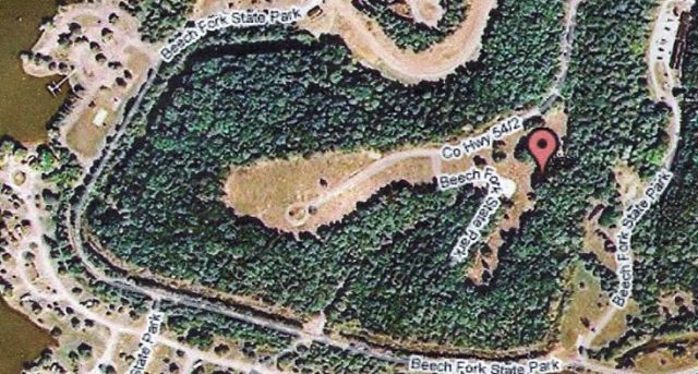
Bowen CemeteryBOWEN CEMETERY
Latitude: N 38°
18. 567 From Interstate 64 in Cabell County, WV. take exit 11 and go South on State Rt. 10. Go about 2 miles and turn Right onto Green Valley Rd. Now go several miles till you come to the top of the big hill. Turn Left onto Camp Branch Road and this will take you to Beach Fork Lake Camp Grounds. Turn Right into the park and take the road till you come to the Bowen Cemetery sign. Turn right and go up the hill to the cemetery. The cemetery is in Cabell and Wayne Counties. The older part of the cemetery is in Cabell County. The cemetery is on property that belong to Hugh Bowen before the counties were divided. This cemetery is very large so I chose to brake it down into 5 sections.
They will be called ----- Make your selection on the Left side
|