|
|
||||||||
|
Doors to the Past |
||||||||
Adkins )Goba)ADKINS (Goba)
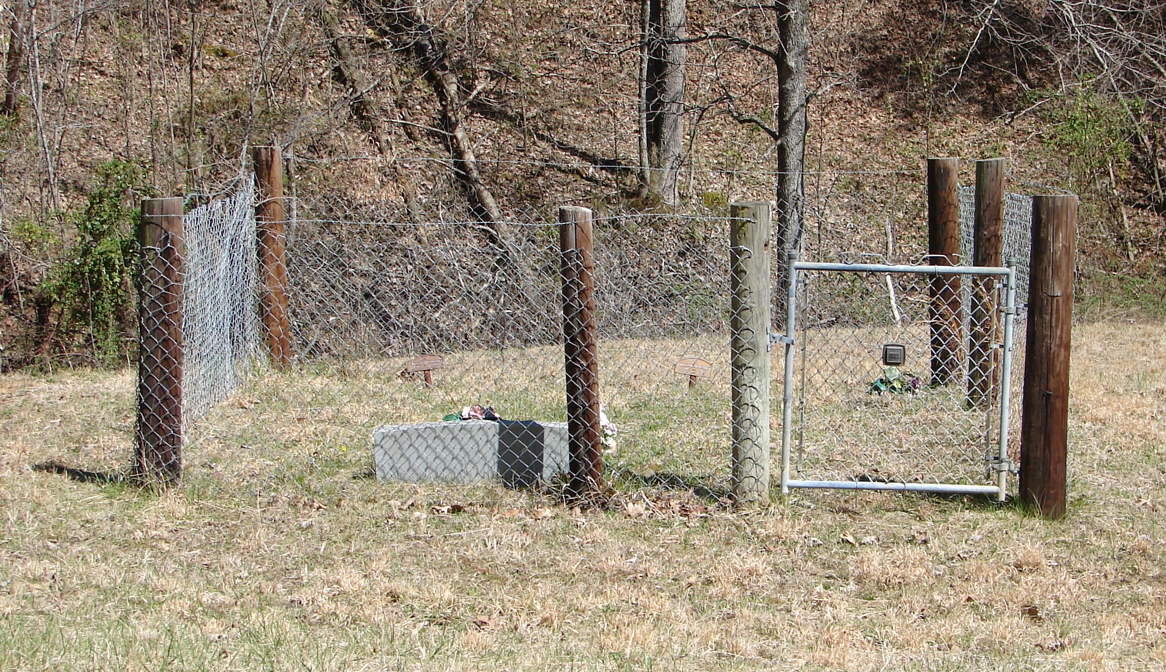
CEMETERY
Adkins (Goba) Detail ListLatitude: N 38° 16.010 From US Route 60 in Cabell County at Barboursville, WV.
Take Alt. 10 and Route 10 South
to you come to Salt Rock. At the Chevron Gas station turn Right onto
Madison Cr. Rd.
Go about 5.6 miles or till you come to Bowen Creed Rd. Now go 3.6 miles or
till you come
to Hughes Branch/Raccoon Creek Rd. Turn Left and go 1.5 miles or till you
come to Beach Fork
Rd. At this junction in the road keep Left and you will still
be on Raccoon Creek Rd. Also there
is a sign for Bethlehem United Baptist Church at this junction. (All
mileages will be from this
point) Now go 0.8 mile and turn Left up a gravel road. Go1
mile or till you come to the last house
on the road. The
cemetery is up the hill behind the barn.
The cemetery is fenced and maintain. The following list was compiled by actual reading of the tombstones. All the information, excluding annotation, is written on the tombstone. Read April 05, 2006.
WALLACE FUNERAL HOME (Both)
|
||||||||