|
|
|
|
Doors to the Past |
|
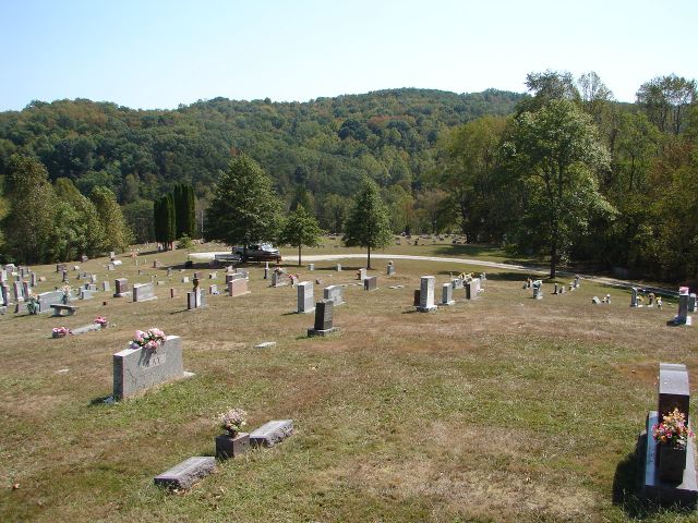
Enon CemeteryENON CEMETERY
Latitude: N 38°
20. 774 From Barboursville take Route 10 to Salt Rock, Cabell County, West Virginia and cross the Railroad tracks and go to the Exxon gas station on the Left side of the road. Turn Left on McComas Road and go 0.6 miles and turn Right onto Tyler Creek Road and go 1.5 miles or till you come to a sign that has Enon Cemetery on it (Right hand side of road). Now turn Left on the gravel road and go up the hill to the cemetery. The cemetery is not fenced but is well maintained. Read September 2008 Submitted by Barry Huffstutler. Note: The cemetery is quite large and I broke it down into 3 sections for the propose of being able to read it. They will be called Section A - B - C. Section A is the part of the cemetery that is located on your Left (Top Part). Section B and C are the 2 sections on the lower part of the cemetery. As you exit the cemetery Section B is on the right of the road --- Section C is on the Left of the road. Note: If a name is listed in "BLUE" you can click on it and it will bring up a picture of that person.
|